This is a very demanding path which brings you to the southern brink of the Bove Valley, it is suitable only for people with a medium level of physical fitness. The best periods to undertake this trail are surely spring and autumn. During the summer we recommend trying in the very early morning in order to avoid the heat of the sun, while in the winter it is better not to attempt because even without snowfall the low temperature would make the underfoot conditions very difficult.
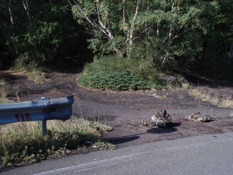
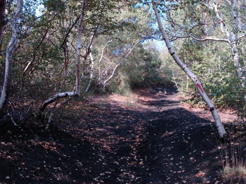
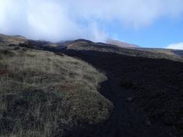
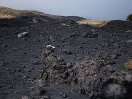
The path starts at Rifugio Citelli, at an altitude of 1750m. Leave the car in the opening in front of the rifugio and walk back roughly 100m along the roadway you arrived on, until you find the entrance to the path on the left. As unfortunately happens on Etna, the beginning of the path is not clearly indicated; in this case the only element which indicates the presence of the path is a painted red marking on the guard rail! As you enter the wood the initial part of the path is quite easy, not very steep, and the trail is marked by several red signs on trees and stones. Emerging from the wood the lava flow of 1928 can be encountered.
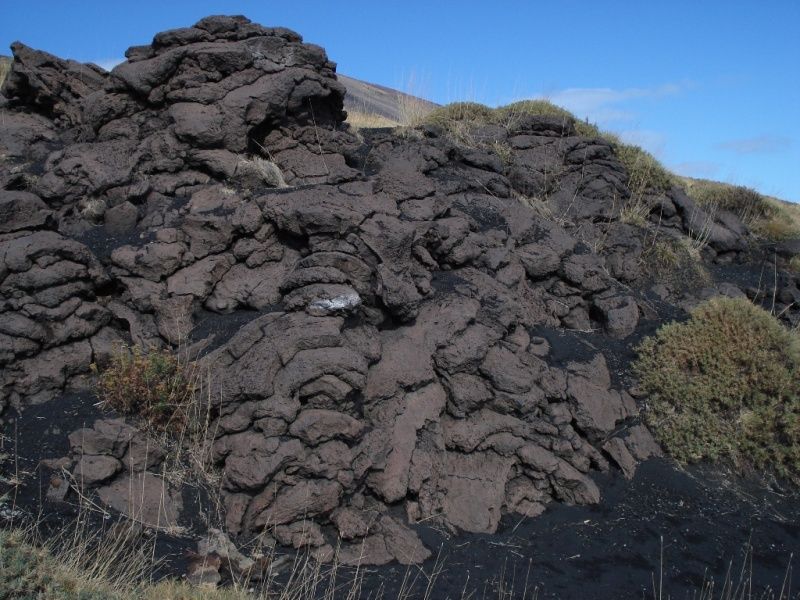
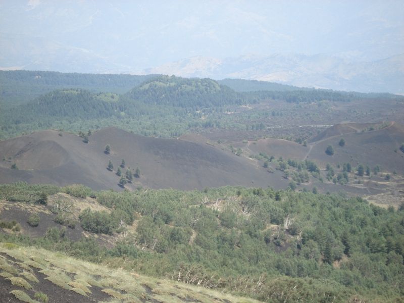
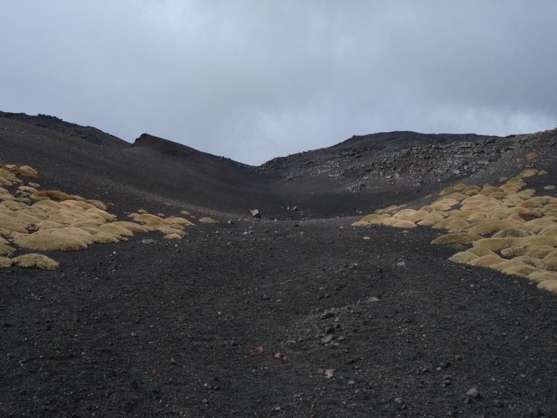
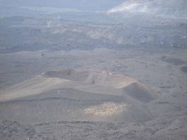
Here, looking at the valley you can observe a view which gives you a hint of the strength and splendour of nature: the remarkable capacity of Etna to destroy and recreate. From here you can admire the ancient craters (hundreds of years old) which are already covered by new pine forests; Sartorius mounts, created during the eruption of 1865, polished over the years but not yet attacked by trees (with the exception of a few solitary pines). The flow which we are ascending, with sharp rocks, is doomed to be covered by plants or by another lava flow. Etna uncaringly has always borne witness to all this change around her.
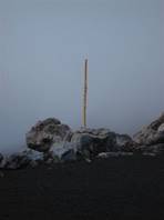
At this point it is possible to ascend the flow; initially, the flow will stay on our right. After a short segment, it will be possible to cut through the flow and carry on up the steep slope leaving the flow on our left. It is very important to cross the lava flow in order to avoid finding yourself in dangerous parts of the path, with high slopes and rocky soil underfoot. This ascent continues for a while; considerable slopes and sandy soil will require a few breaks. The end of the path is indicated by a wooden pole, at an altitude of almost 2400m.
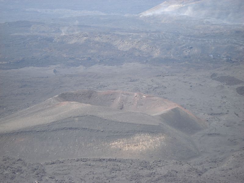
At this point your ascent is complete leaving you only to try to take in the unique and spectacular view of nature with the craters below and lava flows of the past in the valley. These are observable from this height without any risk.
From here, you could keep rising towards the Pizzi Deneri.


Difficulty: medium-high
Difference in height: 600 m
Maximum height: 2370 m
Length: 3 km
Duration of journey: 2 - 4 hours
Suggested season: all season without snow on the path
Technical equipment