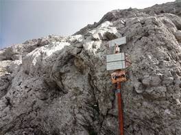
The Guzzi route is the "easy" way to reach the top of the Grigna the side of the shelter Bietti. To be honest, although it is marked as a hiking route to experts, in my opinion some sections are a bit dangerous. You'll be in front of the rock and you'll need to move laterally using your hands. Put a foot wrong would be to take a flight of several meters, so if you are not ready to face such a trail (5/10 meters, but there are), opt for the Ganda route, less scenic but easier.
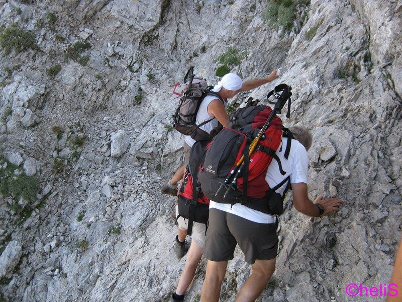
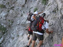
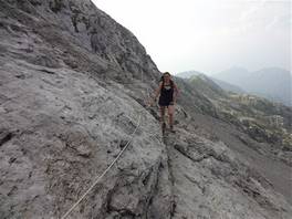
We have seen many people coming back from the Guzzi route, all of them told us that coming back was either a complex task. Of course, I am referring to people who go to the mountains for a walk, for those who are used it is an absolutely ordinary way. Just to give an idea: you'll face the rock in this way, in the photo you can see the "Caminetto" route. As you can see from the picture ... who is used to such a trail, goes on. Thanks to Helis for providing me the photo, you will find the descriptions of his ascents at this link.
The way Guzzi is slightly less demanding of the "Caminetto" route, but it is not a path for everyone. After this introduction, let's go to the description of the route.
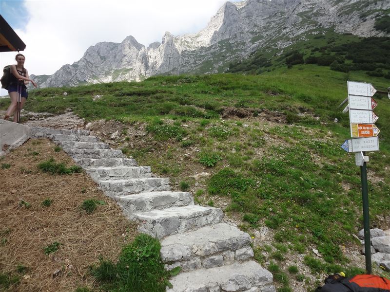
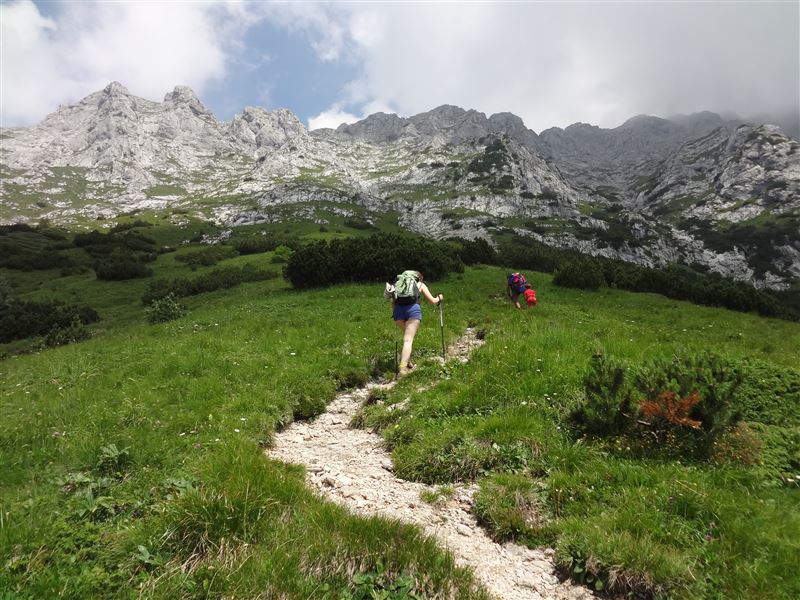
Exactly behind the hut Bietti - Buzzi, a steep climb starts on the lawn. For the first few meters everything goes smoothly, we are walking close to a hikers with his 7 year old son, we think that "if he can rise, we also can... ".

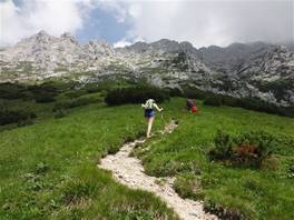
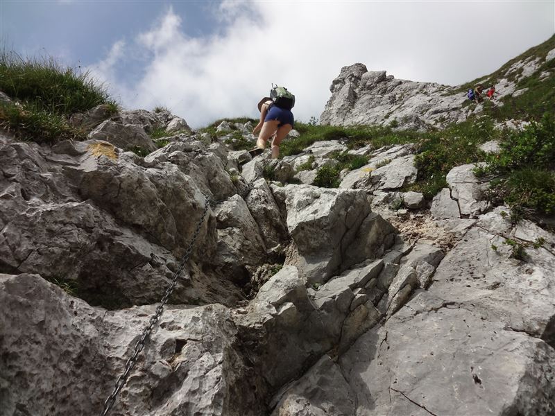
The slope increases, we begin to use our hands, still following the yellow signs on the rock. We are now facing the rocks, the child decides to rise somewhere else (small climbers grow...) and we spend a few minutes thinking: keep going or coming back?
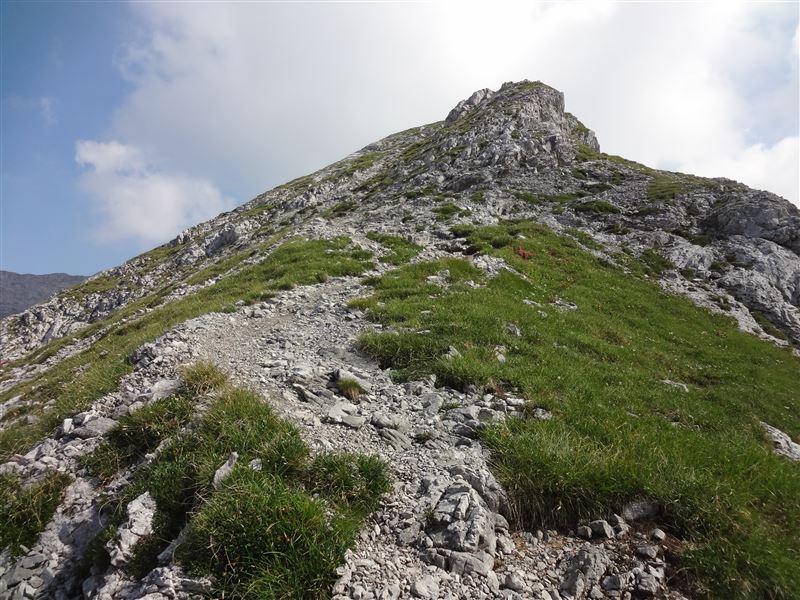
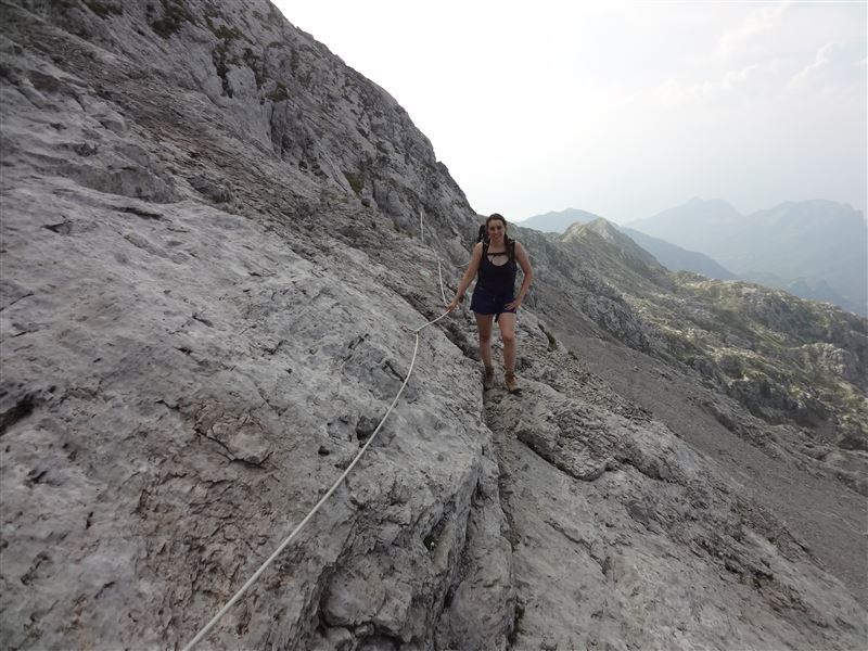
Fortunately, we meet someone who was coming down, telling us that the dangerous point will last just a few meters. After this section, we find these chains that help us to reach the top of this ascent. Go right at the top, we are on the"Piancaformia" ridge. There is only one point where you need to climb a rock but as soon as we leave the ridge we can say that there are no more difficulties.

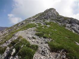
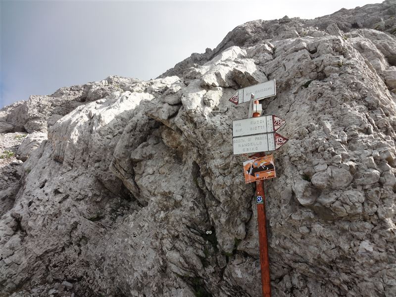
The trail intersects with the Ganda route (trail 25), the most simple way to reach the top, which rises from the Bogani refuge. From now on the path is simple, a walk on the gravel with the support of the chains in the hardest point (but I have seen people without using them).
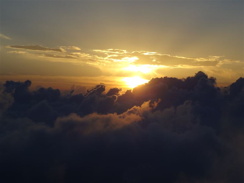
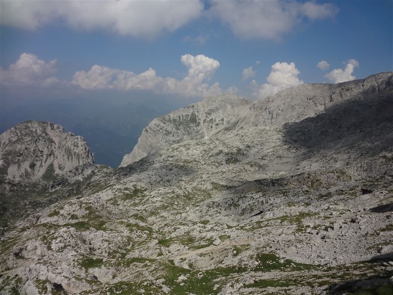
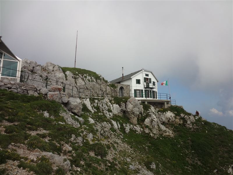
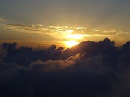
We reach the Refuge Brioschi on the top, unfortunately the sky is overcast and the lake cannot be seen; there is a very nice sunset on the clouds, if there was the sun the landscape would have been like this.
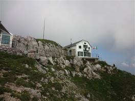
Suggested accommodation: Rifugio Bietti-Buzzi
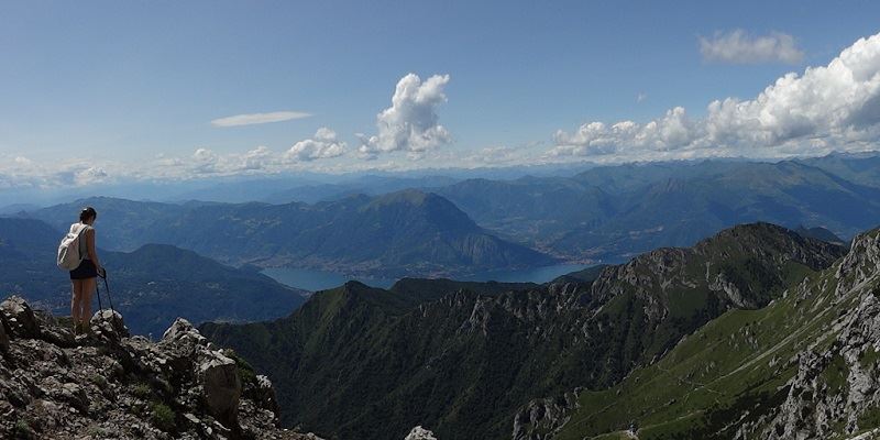
Point of interest: Bietti refuge, Brioschi refuge, Grigna's peak, Lecco lake panorama
Difficulty: High
Difference in height: 700 m
Maximum height: 2450 m
Length: 3 km from Bietti refuge
Duration of journey: 2-3 hours
Suggested season: Summer
Technical equipment : Required
Point of interest: Bietti refuge, Brioschi refuge, Grigna's peak, Lecco lake panorama
Difficulty: High
Difference in height: 700 m
Maximum height: 2450 m
Length: 3 km from Bietti refuge
Duration of journey: 2-3 hours
Suggested season: Summer
Technical equipment